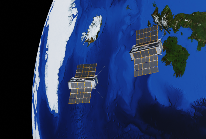
The UK Government has confirmed that the first satellite launch of Prometheus 2 CubeSat will take place later this year from Spaceport Cornwall in Newquay.
Prometheus 2 is a collaborative effort of the UK Ministry of Defence (MoD), the US National Reconnaissance Office (NRO) and other international partners.
As part of a Defence Science and Technology Laboratory (Dstl) project, the satellite was built by In-Space Missions and designed by Airbus Defence and Space UK.
Prometheus-2 CubeSat will take off onboard Virgin Orbit’s LauncherOne rocket, which will be carried by a modified Boeing 747 to a specified altitude.
The two shoebox-sized satellites will operate in low-Earth Orbit, 550km above the Earth, and will be 50km to 100km away from each other at 17,000mph.
Dstl chief executive Paul Hollinshead said: “The Prometheus-2 mission, with the first ever directly owned Dstl satellites, exemplifies the decades-long collaborative relationship with our international allies, and shows how we can best partner with industry.
How well do you really know your competitors?
Access the most comprehensive Company Profiles on the market, powered by GlobalData. Save hours of research. Gain competitive edge.

Thank you!
Your download email will arrive shortly
Not ready to buy yet? Download a free sample
We are confident about the unique quality of our Company Profiles. However, we want you to make the most beneficial decision for your business, so we offer a free sample that you can download by submitting the below form
By GlobalData“It will achieve critical R&D outcomes and help increase our pool of qualified space personnel to help grow the UK’s capability to deliver space systems in the future.”
Each Cubesat will have separate equipment onboard to test different concepts as a pathfinder, in support of the Minerva constellation for future space-based intelligence and surveillance.
Cubesat 1 will include a GPS receiver, a laser detector and a hyperspectral imager, to capture several slivers of pictures over wavelengths of light for high-definition images.
In addition, CubeStat 2 will include two optical imaging cameras, a laser range finder and a GPS receiver. The first wide-angle lens camera will capture a 180° view of Earth’s surface and the second camera will observe Cubesat 1 to support space situational awareness.


