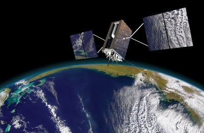
The US Air Force Research Laboratory (AFRL) has selected ITT Exelis to conduct research on the development of a small satellite navigation payload, GPS Navigation Satellite (NAVSAT), intended to serve as a low-cost Global Positioning System (GPS) alternative.
As part of the GPS NAVSAT programme, the company will carry out initial 18-month research to study ways to reduce payload weight, size and power in order to increase affordability and sustainment of the GPS programme.
Exelis Geospatial Systems Precision Instruments and Positioning, Navigation and Timing Systems vice president and general manager Mark Pisani said the development of smaller satellites will yield greater affordability and improved launch vehicle selection flexibility for its customers.
Intended to provide performance capabilities similar to the existing GPS system, the GPS NAVSAT will assist end-users located in signal-constrained urban or mountainous terrain.
Work on the GPS NAVSAT contract is currently being carried out by the company in Clifton and Bloomfield, New Jersey, US.
With more than 500 years of on-orbit life, every GPS military satellite asset is equipped with Exelis payloads and payload components and is designed to deliver increased productivity, safety and effectiveness to military armed forces.
How well do you really know your competitors?
Access the most comprehensive Company Profiles on the market, powered by GlobalData. Save hours of research. Gain competitive edge.

Thank you!
Your download email will arrive shortly
Not ready to buy yet? Download a free sample
We are confident about the unique quality of our Company Profiles. However, we want you to make the most beneficial decision for your business, so we offer a free sample that you can download by submitting the below form
By GlobalDataUsed by other industries including farming, construction, mining, surveying and supply chain management, GPS technology is accessed from cell phones to shipping containers, air traffic management, communications networks, banking systems, financial markets and power grids, among others.
Image: An illustration of the GPS III satellite in orbit. Photo courtesy of ITT Exelis.


