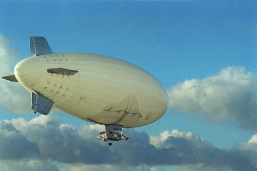
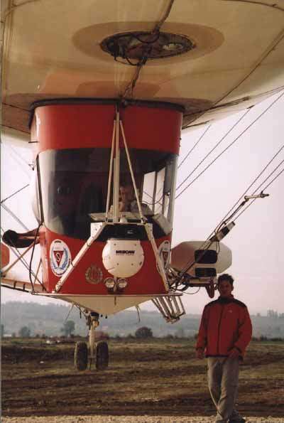
Mineseeker is an airship-based mine detection system, which uses optical and electro-optical surveillance systems and ground penetrating radar to identify minefield areas and to detect mines. The Mineseeker Foundation is a joint venture between the Lightship Group, based in Telford, and Qinetiq, formerly the UK Defence Evaluation and Research Agency (DERA). Trials have been supported by the foundation, by the Mine Action Coordination Centre in Kosovo (UN MACC) and by the Kosovo Force (KFOR).
Mineseeker is used for mapping mined areas and for detecting mines and unexploded ordnance, (UXO), such as mortars and unexploded submunitions. Cluster bomb footprints can be identified and mapped by the detection of bomblets, side panels and spiders from cluster bomb strikes.
The Mineseeker Foundation, working with other humanitarian mine clearance agencies including the Mines Advisory Group and the HALO Trust, plans to deploy five operational airships. A larger airship, the A150, will provide a greater lifting capacity and operating height than the A60 used in Kosovo. A funding initiative has been launched by the Mineseeker Foundation for an £8 million development and trials program to upgrade the system with the integration of advanced interferometry, polarimetry, data processing and motion compensation. Development work on the integration of the sensor and the global positioning system will provide full map overlay capabilities.
Mineseeker airship trials
The system’s capability to detect and image buried and surface laid mines and mined areas has been demonstrated at Qinetiq’s Waterloo Lines test site at Pershore in UK and also in Kosovo, showing that the system will be able to map suspected and confirmed mine areas very quickly, at more than 100 square metres per second. This is several thousands times faster than the technique used by trained deminers equipped with probes, who clear 40m² of mined area per day. The system is able to detect mines in uneven land and cratered sites, areas with dense foliage and areas littered with the debris of conflict.
Assessments of the confirmed and suspected minefield areas and the surrounding land use are crucial in prioritisation of resources for mine clearance programs. The work in Kosovo proved the capability in aiding assessment of minefield extent, entry routes, cleared areas suitable for medical evacuation and also an assessment of whether an area of terrain is suitable for mechanical clearance tools such as ploughs or the use of Explosive Detection Dogs (EDD).
Aerial imaging of minefields
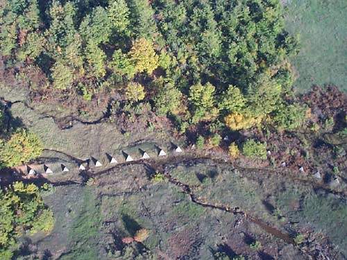
The imaging systems are used to provide an airborne survey by aerial photography. Real time imagery is used to perform fast and effective area searches. A digital stills camera is carried on the gondola for wide angle shots of the search area, showing the boundaries of minefields delineated by dragons teeth markers; the positions of fences and posts marking possible or known minefields; and minefields, which are in the process of being cleared can be examined and mapped.
A gimbal stabilised Wescam Model 14TS camera is mounted on the front of the airship gondola. The camera is equipped with a platinum silicide (PtSi) infrared imager operating at three to five microns and a daylight colour video camera. The operator is able to zoom into areas of interest or areas of potential hazard.
Ultra wideband synthetic aperture radar
The radar detector is the Ultra Wideband Synthetic Aperture Radar (UWB SAR) developed by Qinetiq, based at Malvern. Dundee University was involved in the design of the UWB SAR antennas. An advanced signal processor resident on a powerful computer analyses the characteristics of the radar returns and allows a fast classification of the types of mine being detected.
Kentech Instruments, based in Didcot, Oxfordshire, developed the high switching speed pulse generators operating at more than 1kHz, and a high capacity real time digitisation system capable of capturing signal data received by the radar at rates of 10 giga-samples per second in real time.
Applied Electromagnetics carried out the computational electromagnetics required for mine target signature analysis and developed the system’s advanced signal processing algorithms and wide band SAR processor.
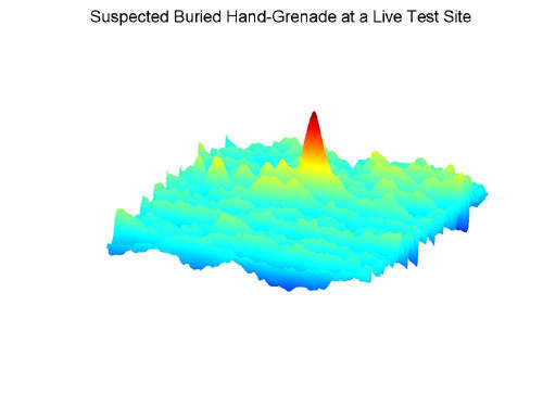
The radar has very high fractional bandwidth that provides a higher resolution at a lower frequency than a conventional narrow band radar. The short pulse duration determines the high accuracy in radar range resolution and the low frequency provides the capability to penetrate foliage and ground. The high resolution and high digitisation rates allow the detection of unexploded ordnance and landmines, including small plastic anti-personnel landmines. Buried plastic mines are difficult to detect by conventional mine sensors but the internal air pockets of buried plastic mines are detectable by the UWB SAR radar.
A-60 airship
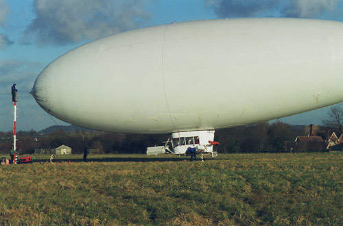
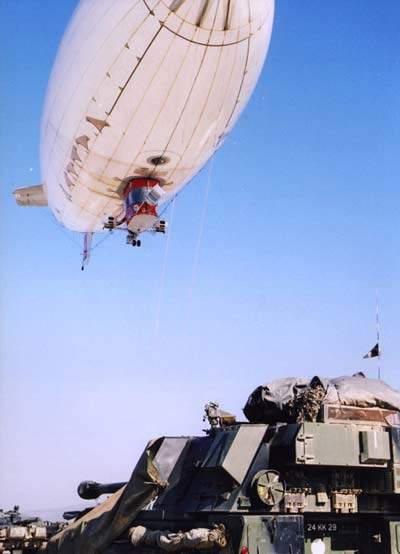
The airship, an American Blimp Corporation A-60, was provided by the Lightship Group. The airship is a low vibration platform to carry the wideband radar and electro-optical payloads, overcoming the limitations of other air platforms such as the helicopter. The airship has a number of advantages. It operates at slow speeds and low levels for long periods of time and also has the capability to remain nearly stationary when required. There is no propeller blade downwash, which reduces the probability of an accidental mine detonation. In areas where a helicopter may be seen as a threat, the airship provides a high public awareness and non-threatening airborne platform for the aircrew to safely overfly the area and carry out the mine survey operations.

